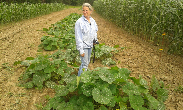
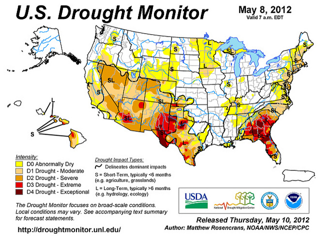
It's not just us. More than half the country is in drought, and almost one third is in a federal disaster area for drought: the biggest ever declared.
Dashiell Bennett wrote for Atlantic Wire today, U.S. Declares the Largest Natural Disaster Area Ever Due to Drought
The blistering summer and ongoing drought conditions have the
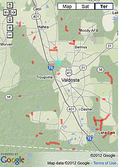
prompted the U.S. Agriculture Department to declare a federal disaster area in more than 1,000 counties covering 26 states. That's almost one-third of all the counties in the United States, making it the largest distaster declaration ever made by the USDA.
The declaration covers almost every state in the southern half of the continental U.S., from South Carolina in the East to California in the West. It's also includes Colorado and Wyoming (which have been hit by devatasting wildfires) and Illinois, Indiana, Kansas and Nebraska in the Midwest. However, it does not include Iowa, which is the largest grain and corn producer in the U.S. This map show the counties affected:
Look, there we are, right in the center of the red area in the southeast!
-jsq